Brief Overview
A total of 11 students supervised for their PhD research work
- 2001- present: 8 PhD students supervised at UNESCO-IHE, The Netherlands,
by myself or in co-supervision with my colleagues - 1991- present: 3 PhD students supervised at Faculty of Hydrotechnics, Timisoara, Romania
Detailed overview of Supervision (at UNESCO-IHE)
PhD Student: A. M. Azab
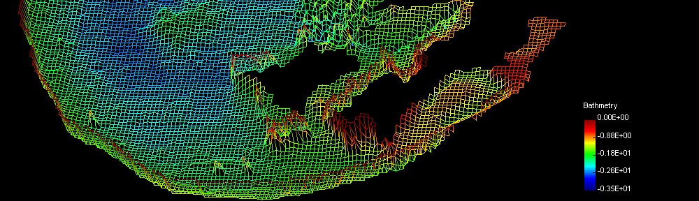
Thesis title: “Integrating GIS, remote sensing, and mathematical modelling for surface water quality management in irrigated watersheds”
Graduation year: 2012
Description of work (abstract):
The intensive uses of limited water resources, the growing population rates and the various increasing human activities put high and continuous stresses on these resources. Major problems affecting the water quality of streams and lakes may arise from inadequately treated sewage, poor land use practices, inadequate controls on the discharges of industrial waste waters, uncontrolled poor agricultural practices, excessive use of fertilizers, and a lack of integrated watershed management. This book focuses on the management of surface water quality in physically complex watersheds and data scarce environments. It presents a generic framework for a Water Quality Management Information System, integrating the physically based hydrodynamic and water quality models with the spatial and temporal capabilities of remote sensing. The developed framework is applied and tested on the Edko drainage catchment and shallow lake system in the western part of the Nile Delta, Egypt. The framework includes a hierarchy of models: 1D-2D basic hydrodynamic model for a combined shallow lake-drainage system, 2D hydrodynamic model of the shallow lake, 2D water quality and eutrophication screening models of the lake. The lake models succeeded to simulate the main water quality parameters including the oxygen compounds, nutrients, temperature, salinity, total suspended matter (TSM) and chlorophyll-a. Additionally, the results of this research showed that the integration of remote sensing data for the calibration of water quality and eutrophication models proved to be a reliable and successful methodology that could be applied on similar physical and environmental conditions.
PhD Student: J. Nham-Chung
Thesis title: “Ecohydraulic modeling of Eutrophication for reservoir management”
Graduation year: 2010
Description of work (abstract):
This study presents a systematic approach to water quality assessment, hybrid modelling and decision support for eutrophication management in deep reservoirs. It is found that during the summer monsoon the catchment runoff into the Yongdam reservoir induces a transfer of pollutants from a middle stratified layer to the surface layer. Although this transport meachanism limits nutrient accumulation on the bottom of the reservoir, it also offers an opportunity for on-going algae production in the surface water. Physically based modelling is used to understand the process of micro-scale turbulent mixing and its impact on the nutrient uptake by algae. Further, a data-driven model using clustering and partial least squares regression which uses results from a physically based model of the reservoir successfully predicts Chlorophyll-a concentrations.
PhD Student: Y. Elwan
Thesis title: “Development of a decision support system for the eutrofication prevention of the Nassr lake”
Graduation year: 2009
Description of work (abstract):
Recent surveys have indicated that Lake Nassr (LN), in Egypt, is subject to pollution hazards originating from uncontrolled discharges of domestic, agricultural and industrial wastewater upstream of Assuan High Dam (ASH), in addition to navigation activities all along the course of the lake. The analysis of collected data indicates that LN receives a limited amount of pollutants that hardly affect the acceptability of its water for domestic, industrial and agricultural uses downstream of AHD. The integrated development of Lake Nasser in sustainable manner is nowadays of prime importance. This stems from the (trend) of developing the LN area on industrial, fishing, and agriculture scales. It is widely feared that the intended development will negatively affect the environmentally healthy area. To protect LN from potential sources of pollution, decision makers are in a dilemma as whether to accept development projects that may bring about negative environmental impacts or to safeguard LN’s actual near-to-virgin status. In this regard, adopting the development approach using the Cleaner Production (CP) principle, introduced at the Earth Summit, in Rio in 1992, holds the promise of improving the environmental performance of LN proposed development. The research of the PhD focused in the development of a decision support system to assist in eutrophication prevention. A 1D mathematical model that assesses the eutrophication of LN was build, along with a decision framework on how to use this model for assessing the water quality of the lake and test the implementation of different adaptive measures.
PhD Student: S. Li
Thesis title: “Optimisation of reservoir operation, for flood defence on the lower Yellow River.”
Due to graduate on: April 2013
Description of work (abstract):
Flood forecasting, flood control and flood management are crucial for river management authorities, especially in catchments with high population densities like the Yellow River and Yangtze River basins in China. At present, numerical simulation models systems are being used to carry out flood forecasting calculations. However, for integrated real-time flood control and management, river authorities need a software system that is able to perform all the necessary computations and analyses related to flood control analysis, scenario development as well as support the decision making process.
In addition to the computation of real-time operational schemes, flood control and management software systems should be able to serve the decision-making process (decision meetings or discussions) that may involve economic, environmental, politicaland other issues. Therefore, the system must be built to be very flexible, powerful-in-function and concise-in-structure, user-friendly, and most of all, efficient in making schemes and scenarios for supporting flood control and management decisions.
In China, most of river authorities, either with single-reservoir or with multi-reservoir, are equipped with flood control and management software systems. The earliest systems were built in the late 1980s. However, most of these river authorities are still working hard to develop new systems. It is clear that the systems presently in use are not so satisfactory. In fact, what should be built in the system and what kinds of functions and capabilities the systems should have are still subject of studies with respect to the end-user’s complaints. Thus, it is a major challenge to develop a really useful and practical software system for flood control and management.
The work carried out in the PhD research focuses on next generation software architecture, exploring an adaptive architecture with new requirement-based philosophy and state of the art software technologies. In the research, the “real-time reactive” approach is employed to form a brand-new operational style for the flood control and management. The research effort is put to the combination of computational and user operational processes with the real-time reactive mechanism and with hydro-professional graphical user interfaces.
PhD Student: C. Wang
Thesis title: “Numerical Modelling of Ice Floods in the Ning-Meng reach of the Yellow River basin”
Due to graduate on: April 2013
Description of work (abstract):
Ning-Meng reach (including Ningxia and Inner Mongolia Autonomous Region) is located at the northern part of the Yellow River basin, with the distance of 1,237 km. Every year in winter, Ning-Meng reach always freeze-up, and during the freeze-up and break-up period, when meet the unfavorable conditions, it is very easily to cause the ice disasters such as dike break etc. Ice regime information and forecasting is the most important scientific supporting measures for ice flood control, regulation and decision making. Following the development of the integrated water resources management of the Yellow River, the requirement of the water regulation of the upper Yellow River in ice flood period not only safeguard the ice flood, also satisfy sufficiently utilize the limited water resources. So it brings forward the higher requirement for the ice regime forecast content and its leading time and precision. In order to solve the above mentioned problem, the Yellow River Conservancy Commission (YRCC) proposed to build up ice regime flood numerical model for the Ning-Meng reach to simulate and forecast the ice processes during the ice flood period.
Although up to now, there are several one-dimensional and two or three-dimensional ice regime numerical model have been build up in some rivers in the world, they only has the simulation purpose and only applied in short distance river courses and also can not make forecast. Due to complexity of the river ice phenomena in each period, should calculate the water balance and thermal balance respectively according to different criterion and to make the water balance adjustments. In order to build up the ice regime flood numerical model for the Ning-Meng reach with the distance of 1,237 km, several difficulties should be solved, such as how to consider the river channel boundary conditions; river ice transport processes, which including the transport of thermal energy, formation and evolution of frazil ice, undercover transport of frazil granules, and surface ice transport and jam formation; the coupling of meteorological model with ice regime numerical model etc. The generalized ice regime flood numerical model is proposed to make for the Ning-Meng reach which consists of 5 modules: (1) preprocessing of meteorological data module which process the observed meteorological stations data and meteorological numerical model output coming from CMA and Hyper-computer Center of YRCC respectively: (2) preprocessing of hydrological data module which process the observed hydrological data from hydrometric stations; (3) initialization of ice regime module which process the observed ice regime from hydrometric stations; (4) thermal balance calculation module and (5) dynamic balance calculation module. These last two modules are the main part of the model and should couple each other during the model calculation.
The principal aim of this study is (i) to analyze ice regime variation regular laws and characteristics of the Ning-Meng reach in recent 50 years, especially after the Liujiaxia reservoir put into operation in 1986; and (ii) to build up the generalized ice regime flood numerical model for the purpose of the decision making supporting for ice flood control of the Yellow River.
PhD Student: A. Almoradie
Thesis title: “Network Distributed Support System for Collaborative Citizens’ and Stakeholders Participation in Management of Water and Environmental Resources”
Due to graduate on: April 2013
Description of work (abstract):
Water related natural disasters are a major cause of damage to properties and lose of human life compared to other natural disasters. Water and environment resources management aims to mitigate these negative impacts. Mitigating the negative impacts such as flooding is a complex process. It needs to deal with the management planning that integrates science, social and technology. Since the main concern of water and environment resources management is for the health and safety of the public from an impending disaster several issues needs to be tackle with the following questions: How to mitigate? How to approach the public or citizen with this mitigation measures? How to implement this? With these questions, science, social and technology comes as an answer. Several research in a DSS (Decision Support System) in water related and environment resource management were implemented but most of them failed. One of the major causes of its failure is due to the lack of the public or stakeholders interest. Most of the DSS disseminates the mitigation measures, information and decision in a classical approach (one way dissemination). Several papers cited that the involvement of the citizen and stakeholders in the decision making process and management is critical for the success of the support system. This gives awareness and interest to the citizen and stakeholder to participate in the system.
In this PhD research the Collaboration of the Citizens’ and Stakeholder Participation (CCSP) in the Water and Environmental Resources Management using Network Distributed Support System (NDSS) is envisaged as an approach. The advancement of ICT (Information and Communications Technology) in this changing society paved a way to use these latest technologies for scientific purposes, management planning and for the involvement of the citizens’ or stakeholder in the system. The challenge is in constructing a framework for the NDSS in CCSP in water and environmental resources management.
